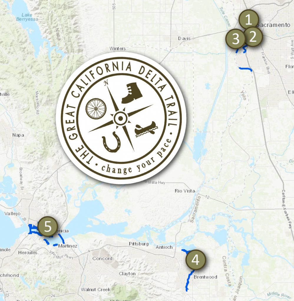
Great California Delta Trail
The Great California Delta Trail is envisioned as a continuous regional recreation corridor extending around the Delta, including the shorelines of five Delta counties, and linking trail systems from Sacramento to the San Francisco Bay.
Annual Events | How the Delta Trail Will Grow | Delta Trail Master Plan
There are five designated segments of the still-growing Delta Trail:
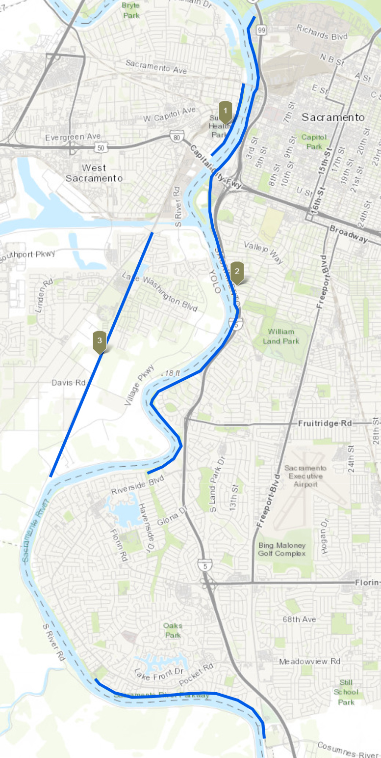
- West Sacramento River Walk
- Length: 2.9 miles
- Terrain: flat
- Highlights: An ideal place for a lunch-time jogging, dog walking, picnicking, and enjoying scenic views.
- AllTrails page
- Detailed map
- Sacramento River Parkway
- Length: 9.5 miles
- Terrain: flat
- Highlights: Goes from Old Town Sacramento to the Pocket neighborhood.
- AllTrails page, City of Sacramento page
- Detailed map
- Clarksburg Branch Line Trail
- Length: 8.6 miles
- Terrain: flat, some gravel sections
- Highlights: Ideal for nature lovers who don’t want to travel too far to feel immersed in nature.
- AllTrails page
- Detailed map
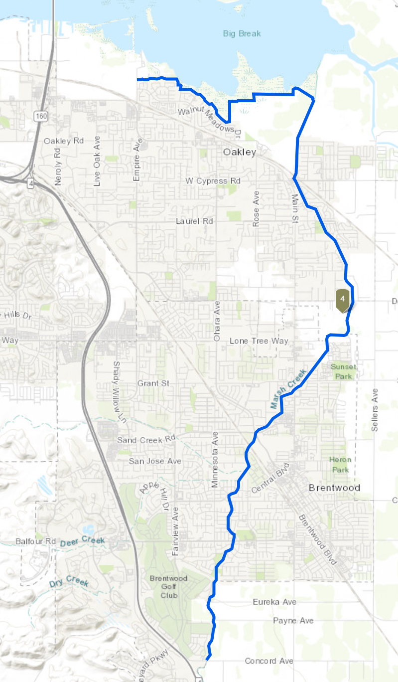
- Big Break and Marsh Creek Trail
- Length: 9.1 miles for Big Break section, 14.9 miles for Marsh Creek section
- Terrain: 82-foot elevation gain for Big Break section, 147-foot for Marsh Creek section
- Highlights: If you enjoy fishing, hiking, biking, or kayaking, this is the trail for you!
- AllTrails page, East Bay Regional Parks page
- Detailed map
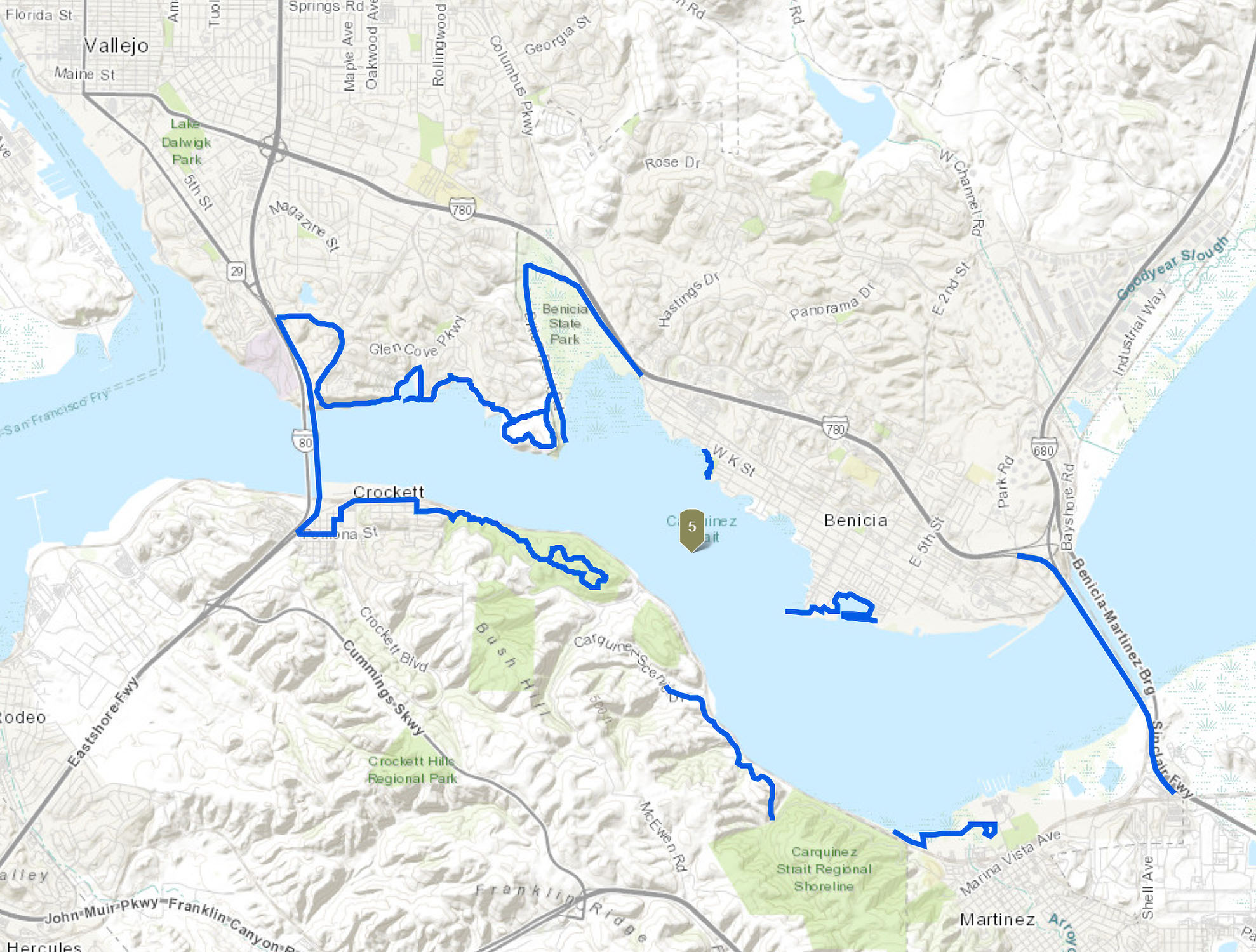
- Carquinez Strait Scenic Loop Trail
- Length: 50 miles
- Terrain: Elevation gain of as much as 1,745 feet in sections that go up to ridgelines.
- Highlights: Connects to over 10,000 acres of parks and open spaces and five bustling, historic communities.
- RidgeTrail.org page, AllTrails page
- Detailed map
Annual Events on Delta Trails
East Bay Regional Park District Trails Challenge: To finish the challenge, participants need to walk, ride, or roll five trails or 26.2 miles. Walking, biking, and horseback are all ways visitors can participate.
Ridge Trail Challenge: Every year, the organization challenges hikers, mountain bikers, equestrians and runners – beginners and experts alike – to get out and explore the Ridge Trail.
Sacramento Century: The bike ride starts from Capitol Mall in downtown Sacramento and winds through the scenic Delta wine region to Isleton, then back to the Mall. There are four routes: 100 mile, 63 mile, 36 mile, and 16 mile.
Stockton Bicycle Club Delta Century: The Delta Century includes three routes, a 100 mile, 62 mile, and a 26 mile route. There are no hills, and the only climbing is for bridges and levees. This makes for an ideal first century or organized ride.
How Will the Trail Grow?
Existing and new trails can be added to the system, provided they meet requirements in the adopted plan (PDF). The goal for the Delta Trail is to include routes for bicycling and hiking, with interconnections to other land and water trail systems, recreational facilities, and public transportation. Water trails could provide continuity in places where land trails are not feasible.
When complete, this regional trail will connect communities with a long-distance, primary trail corridor linked with boat launch sites and access trails leading to and from key destinations.
The Delta Protection Commission was designated by the Legislature as the party responsible for developing a master plan for the Delta Trail, and acts as a coordinator working in partnership with local parks, recreation, and trails organizations to coordinate planning and implementation. Trail segments are conceived, developed, built, and managed locally.
The Great California Delta Trail Master Plan
Great California Delta Trail Master Plan (PDF) – Large File 16 MB
- Appendix A – Public Survey Summary (PDF)
- Appendix B – Background Document Review (PDF)
- Appendix C – Rail Trail Development (PDF)
- Appendix D – Levee Managers Survey Summary (PDF)
- Appendix E – Operations and Maintenance (PDF)
- Appendix F – Funding Sources (PDF)
- Appendix G – Liability and Risk Reduction (PDF)
- Appendix H – Delta Trail Master Plan Trail Designation (PDF)
- Appendix I – Public Workshops (PDF)
- Appendix J – Public and Stakeholder Comment Summary (PDF)